About Nyeri
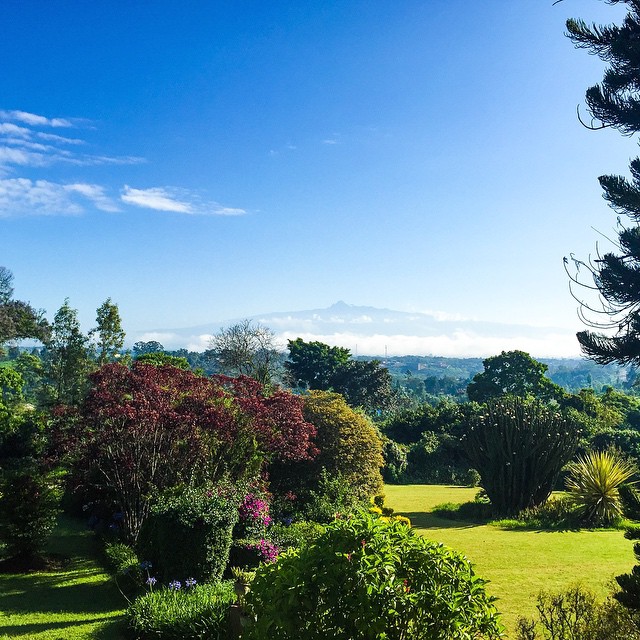
Nyeri is one of the coffee industry’s most prized growing areas. Most of the production is centered between Mt. Kenya and the Aberdare mountain range. With the perfect mix of high altitude, quality varietals, and climate, it’s a garden of eden for top coffee lots.
With a population of 661,156, Nyeri County residents are predominantly farmers growing tea and coffee as cash crops alongside food crops such as maize, beans, assorted vegetables and sweet potatoes.
This place is very much the self-announced access point to the Central Highlands of Kenya. Its excellent spot on the very verge of the Aberdare Mountains, within range of the Aberdare National Park (abode to leopards, African wild dogs, leviathan wild hogs, cape buffalos, rhinos and more), Mount Suswa and the South-western Mau Reserve makes it a true attraction for outdoor lovers!
Nyeri County, former Central Kenya HQ is 150 kilometers North of Nairobi. It covers an area of 3337 square kilometers. The word Nyeri is derived from the Maasai word 'nyiro' meaning red.
Nyeri is a small town that forms the country"s administrative headquarters for the Kenya"s central province. It is 150 km north of Nairobi in the densely populated and fertile central highlands lying on the base of Aberdare Ranges.
Nyeri is the home of Aberdares National Park which is only 15 kms out of town. Mt Kenya, the imposing land mark around Nyeri and 20 kms out of town is the Mt Kenya National Park.
It was formed around the 1902, when the British were establishing their colonial presence and defeated the native Kikuyu and build a British post there. Soon the European settlers, missionaries and Indian merchants began to migrate into Nyeri and it burgeoned into a trading centre. Majority of Nyeri residents are of the Kikuyu ethnic group, which is the largest ethnic group in Kenya.